Anthropic has announced a suite of productivity tools to take on Microsoft Office and Google Workspace.
The new tools include Claude Sheets for spreadsheets, Claude Whiteboards for collaborative digital whiteboards, and Claude Data.
The company will also offer Claude Meetings, which lets you add Claude to a call so it can take notes and update documents for you.
Microsoft Office and Google Workspace are two of the most notable productivity suites around, powering businesses around the world. Now, it looks like Anthropic wants a piece of this pie, as it just announced a trio of workplace tools.
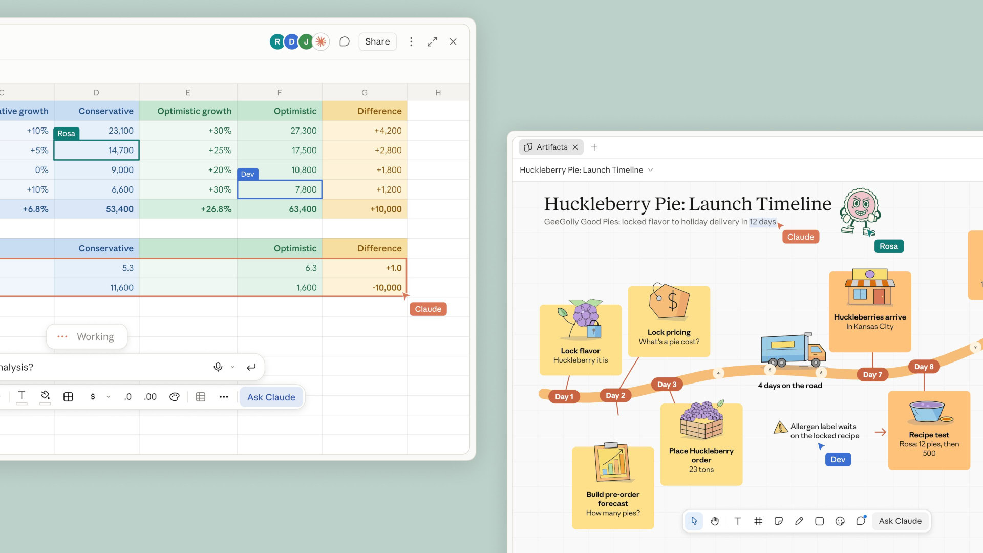
Anthropic announced via its Claude account on X that it’s now rolling out Claude Whiteboards, Claude Sheets, and Claude Data. Starting with Whiteboards, the company says you can talk through a plan and have Claude lay it out on a digital whiteboard that can be edited by your team.
Meanwhile, Claude Sheets is effectively an Excel and Google Sheets rival. Anthropic says you can use Claude Sheets to “ask for a tracker or a budget” and then subsequently receive a spreadsheet that people can work on.
Readers’ poll
Do you use AI for work?
4 votes
Claude Data is actually a rebranded version of the company’s Dashboards feature, which lets you ask questions about company data and turn them into dashboards, narrated videos, data stories, and more.
“You can also ask Claude to build custom artifacts for the way your team works, like an account tracker, a daily briefing, a project status board, or a contract review table,” the company explained in a support article. “Since Claude carries the same context through every step, an idea can carry over from a whiteboard to a spreadsheet to a dashboard, without the need to reiterate the details.”
All three tools are now available on paid plans. Furthermore, Anthropic is following rivals like Google and Microsoft by offering Claude Meetings. This upcoming feature will let you add Claude to a call to take notes and update documents.
Dirt Clicker is a super satisfying incremental digging game where dirt is your currency & buried treasures are just a few scoops away.Wielders of the Essence
Start with nothing but a spoon and a patch of dirt. Dig your way through the ground, uncover treasures and build up your fortune by investing in better tools. Unlock a growing collection of upgrades, from shovels and pickaxes to jackhammers and beyond, each helping you dig up even more dirt. You can’t keep digging by yourself forever. Get some pals like the; Mushrooms, Frogs, Golems or any of the other creatures to keep it going while you focus on the more important stuff.
Spend your well earned dirt in a massive skill tree, you can upgrade your tools & unlock ways to strengthen your pals. Every upgrade makes digging just a little easier and faster. When you’ve dug as deep as you can, it’s time to Prestige! Reset your progress, turn your hard-earned dirt into precious worms, and spend them on permanent upgrades that reshape the way you play. Unlock new systems, discover powerful synergies, and turn every new run into an even bigger digging adventure. Every new layer has something new waiting for you! Dig up valuable treasures and rare relics. Some are worth selling, while others are harder to find and give you an extra boost. Open chests & equip your pals with hats that have game changing effects. You might stumble upon strange little surprises throughout the world.
Screenshots
SystemRequirements
Minimum
OS: Windows 10
Processor: Intel i7 2.6 GHz
Memory: 4 GB RAM
Graphics: Geforce 1650 Ti
Storage: 100 MB available space
Support the game developers by purchasing the game on Steam
InstallationGuide
TurnOff Your Antivirus Before Installing Any Game
1 :: Download Game 2 :: Extract Game 3 :: Launch The Game 4 :: Have Fun 🙂
I spend way too much time on wikis reading about spin-off games made for handheld and mobile devices I will probably never play (there was a whole trilogy of Silent Hill: Orphan games that have lived up to their name by being orphaned on old phones). The Elder Scrolls Travels are a prime example—games made in the gap between Morrowind and Oblivion. The third in the series, Shadowkey, came out on Nokia’s N-Gage handheld—a cross between a GameBoy Advance and a mobile phone that lasted two years before being discontinued in 2005.
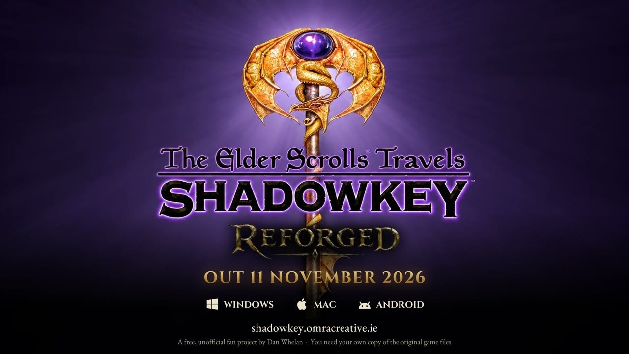
This first-person RPG is about to return thanks to Dan Whelan, whose Shadowkey Reforged project will let us play Shadowkey in widescreen with controller support and upscaled graphics. You can choose to play in classic or modern mode, but you can also toggle individual features one by one. Modern mode isn’t just a graphical upgrade as it also adds features from the later mainline Elder Scrolls games like stamina-based sprinting, stealth, and ragdoll physics.
This is one of those times where I prefer the original game’s look, as the brutally abrupt draw distance leaves a lot to your imagination while the modernized version seems to show enemies looming unresponsively in the near distance. And it’s not like the upscaled character models actually look good, despite being beyond what Nokia’s taco phone was capable of displaying.
Latest Videos FromPC Gamer
While Shadowkey was never particularly well-ranked in the pantheon of Elder Scrolls games, people did praise its use of the Morrowind soundtrack, which Shadowkey Reforged will continue. Point it to your Morrowind install and it’ll borrow both music and sound effects from the best Elder Scrolls game.
To answer the obvious question, Whelan says in the FAQ: “I used AI to assist with coding and building the engine, and with debugging. I used AI image generation combined with Photoshop and some manual sprite editing to create most of the modern, higher resolution artwork.”
Whelan plans to release Shadowkey Reforged on November 11, which is just 18 hours away at the time of writing. You’ll be able to download Windows, Mac, and Android versions from the website, though you’ll need the original game’s files from your Nokia N-Gage as well, or whatever abandonware site you frequent.
Keep up to date with the most important stories and the best deals, as picked by the PC Gamer team.
OpenAI has acquired an AI travel agent called Odessia, according to Odessia’s founder, Francis Davidson. Davidson says in a post announcing the deal that he’s now working for OpenAI, helping the AI lab with the future of travel.
Terms of the deal were not disclosed, but this looks like an acqui-hire. Davidson’s announcement focused largely on how he built his AI travel agent Odessia by directing teams of AI agents. The year-old Odessia raised a $6 million pre-seed round led by Sequoia and launched its AI travel agent around five months ago. Davidson says that it had helped early adopters plan millions of dollars’ worth of travel, but the tool has already been shut down.
OpenAI did not announce this acquisition, nor confirm it to TechCrunch, when asked. Nor has it announced new travel-specific products or plans. It does, however, count such companies as Bookings.com, Expedia, and KAYAK as customers or partners.
Travel is one of the main areas that people are using personal AI assistants to help with. And, back in July 2025, when OpenAI launched its ChatGPT agent, it mentioned travel as one of its potential uses.
Acquiring Odessia is interesting for another reason. Davidson is well known in the travel industry after he founded a travel startup called Sonder as a college student in 2014. It was sort of like Airbnb, but it focused on leasing upscale apartments in major cities worldwide. The pandemic badly hurt it, and as it climbed out of that rut, it went public via a SPAC but didn’t raise as much money as it needed, Davidson later said in a post announcing his resignation as CEO in June 2025.
When a key partnership with Marriott fell through, the company went into bankruptcy and wound down. The bankruptcy trustee sold Sonder’s name, trademarks, and website domain in 2026 to TravelAI, and that website operates as a curated guide to the kind of travel rental properties that Sonder was once known for. Prior to its downfall, Davidson had built Sonder into a unicorn with $143 million in revenues. While Sonder was not, ultimately, a success story, Davidson is the kind of battle-scarred founder that Silicon Valley often values.
So we’ll have to wait and see what OpenAI has in store now, with his joining the company. OpenAI has not yet responded to a request for comment.
When you purchase through links in our articles, we may earn a small commission. This doesn’t affect our editorial independence.
Two years after the release of Unknown 9: Awakening, its one and only game, Bandai Namco’s Reflector Entertainment is closing.
The shutdown was revealed in a notice posted by Banda Namco (via Game Informer) saying the company “has passed a resolution to dissolve and liquidate its consolidated subsidiary Reflector Entertainment.” The decision was made “after comprehensively considering future business plans, necessary additional investment, and the possibility of profitability and business continuation,” Bandai Namco said.
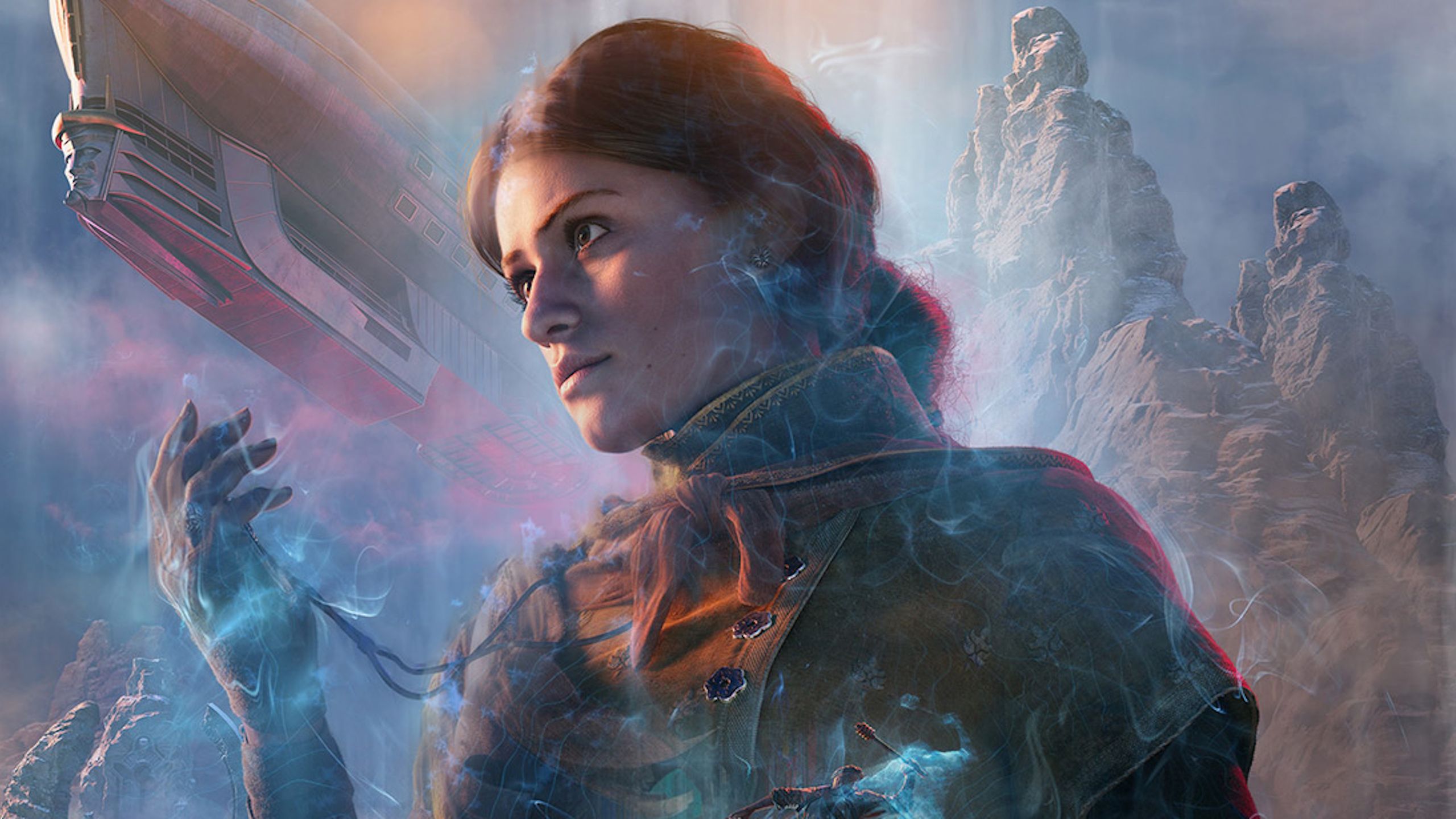
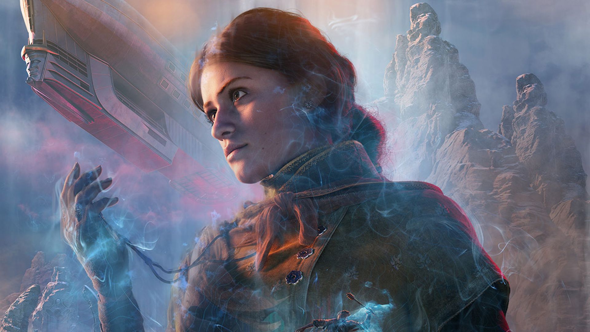
Unknown 9: Awakening, featuring The Witcher star Anya Chalotra as a woman able to travel into a mysterious dimension known as the Fold, showed potential in our pre-release preview as a “linear, narrative-driven, set-piece laden” game drawing from Xbox 360 releases of the late 2000s.
Latest Videos FromPC Gamer
The full game, however, landed with a thud. A month after launch, Reflector laid off 18% of its workforce; a few months after that, in January 2025, more layoffs followed as an in-development project was cancelled. Reflector CEO Herve Hoerdt said at the time that the decision “correlates directly with the failure of the studio’s ambitious and courageous first project [Unknown 9: Awakening],” which “didn’t come near the company expectations.”
Reflector confirmed the coming end of operations in its own message on LinkedIn, writing that “after reviewing the progress of our latest project in pre-production, future development requirements, and current market conditions, Bandai Namco concluded that it could not justify several more years of investment.”
Bandai Namco said the liquidation of Reflector Entertainment is expected to happen “once the necessary procedures according to local laws are completed,” but a concrete schedule has not been set.
From the creators of Edge: A free weekly videogame industry newsletter, featuring in-depth news, expert analysis and exclusive interviews
Back in 1997, Final Fantasy 7 on PS1 felt as glossy and cutting-edge as you could get for an RPG or otherwise. Now, for 2027, Final Fantasy 7 Revelation and its remake trilogy predecessors feel just the same way. Closing out the saga, this series is a reimagining of an epic saga with just the same sensibility as its source material, respectful of recreating what came before while also making seriously bold moves with how it reimagines it. After all, at the end of Final Fantasy 7 Remake, it became clear its remake title was as much verb as adjective, breaking down the notion of what it means to break down and re-craft an icon.
Square Enix are in a lucky position with tackling this monumental task, with a cohesive development team not just across the trilogy but one that stretches back to the original game in the ’90s as well. Final Fantasy 7 Revelation‘s imminent conclusion isn’t just a testament to the quality of the original game, but the team that made it. “Everything in the game has to feel both nostalgic and new at the same time,” says series director Naoki Hamaguchi, speaking on the upcoming final release.
Old and new
(Image credit: Square Enix)
“There’s a very consolidated and consistent philosophy we have going through the whole of the trilogy in terms of how we balance [old and new],” says Hamaguchi. Combining both feelings is “the mission for this whole project”.
Latest Videos FromGamesRadar+
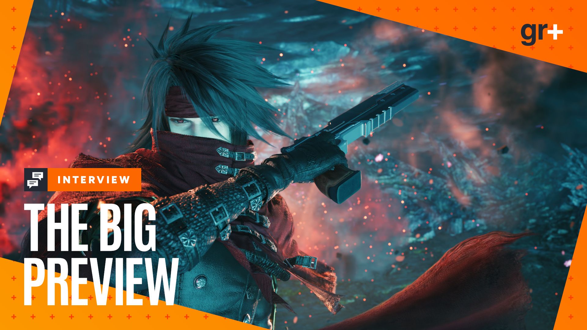
Big Preview
(Image credit: Square Enix)
With the remake trilogy drawing to a close early 2027, we get ready for the epic conclusion with our Final Fantasy 7 Revelation Big Preview across hands-on impressions, dev access, and deep dives into the whole adventure so far.
Which is one of the reasons the trilogy also serves as a pseudo-sequel as well as retreading old ground. “We realized this fairly early on,” he says. “In terms of the storyline – especially the main storyline – if it is just exactly the same story from the original game, then as the series continues, will people lose interest just because they know what’s coming?”
Even when Final Fantasy 7 Rebirth hits a lot of the beats we’re familiar with from the globetrotting adventure that underpins the PS1 original’s middle act, by credits we’re still left second-guessing quite what the villainous Sephiroth’s true machinations are, and how much of what we’ve come to know we can trust. Final Fantasy 7 Revelation has plenty of room to surprise with exactly how it approaches sticking the landing. Even if it’s much the same as its source material, the journey to get there promises to be very different – which may change how we end up feeling about it. “We have to do something to keep that interest up and add that surprise and that uncertainty going through it,” says Hamaguchi.
(Image credit: Square Enix)
When it comes to making those changes, however, “there’s a very limited number of people on the team who are in charge of that,” Hamaguchi explains. “Adding completely new developments and aspects to the story,” is far from a simple matter, especially for a story as dear to fans and developers alike as FF7 – but it’s part of what makes the trilogy remain new and exciting. “Things like the Whispers, for example, where they turn up and the timeline might have changed, or when you see Zack in a different dimension and wonder how that’s affecting it. […] All those extra elements that are really part of that design.”
“I want to leave [those decisions] to the original Final Fantasy 7 creators,” clarifies Hamaguchi. “They have to approve that and come up with those big changes themselves. So that’s people like obviously Mr. Kistase, Mr. Nomura, Mr. Nojima, Mr. Toriyama as well – Motomu Toriyama – and myself. Obviously, I’m involved in that, but they are the ones who have to be making the big changes. It’s not the rest of the team.”
Sign up to our Switch 2 Spotlight newsletter to make sure you get the very latest news on Nintendo’s new console and its games every week
But changing and redefining the narrative of Final Fantasy 7 is only one part of how Final Fantasy 7 Revelation and its predecessors have evolved what came before. “The other type of change is going deeper, the fleshing out of existing content, how that’s reimagined for the modern gaming environment,” says Hamaguchi. “That’s something I think that I really want the younger generation, the new creators, to be working on.”
(Image credit: Square Enix)
Where once we explored this world through a somewhat abstracted top-down perspective, now we get to explore and get lost in immense levels of detail. That’s true both in terms of scale and visuals, but in battles too, which mix together turn-based tactics with real-time combos.
[We have] the original creators doing big changes and the reimagining done by the new guys.
Naoki Hamaguchi, director
“I think by splitting it to have the original creators doing big changes and the reimagining done by the new guys – that balance works really well, and that’s why we managed to achieve that feeling that we really set out to do,” he says.
Hamaguchi really means what he says about the original team being solely responsible for the narrative changes to Final Fantasy 7. “That’s not taking fan expectations or fan feedback into account really at all,” he says. “That fan feedback is looked at for other aspects of the game, but [the big changes are] really consistent with the creators’ vision. I think, ultimately, maybe quite paradoxically, that is actually better for the fans in order to do it that way.”
(Image credit: Square Enix)
While plenty of Final Fantasy 7 Revelation’s biggest changes – alongside those in FF7 Remake and FF7 Rebirth – are completely fresh, some of those tweaks are informed by expansions to the series lore that came after the PS1 in the first place. “One of the other ways we’re approaching the wider Final Fantasy 7 universe, the compilation content [is] the mission the team has is to basically recreate a new Final Fantasy 7 that includes all of that wider universe content from the start,” says Hamaguchi. “So that’s all consistently part of the world in the games that people will be playing.”
Ideas from the likes of prequel Crisis Core: Final Fantasy 7, movie sequel Advent Children, and even multiple phone games have wormed their way into the mixture that is the Final Fantasy 7 Remake trilogy. It’s a novel approach to adaptation that has worked well for other projects taking a similar approach. I’m reminded of HBO’s Knight of the Seven Kingdoms, which adapts George RR Martin’s Game of Thrones prequel from 1998 but makes smart decisions to incorporate aspects of worldbuilding he only thought of many years after the fact – like the Blackfire Rebellion.
(Image credit: Square Enix)
Likewise, plenty of groundwork has been laid across the FF7 Remake trilogy so far to fold in Compilation of Final Fantasy 7 material, leaving plenty of plot threads dangling for FF7 Revelation to tie up. Hamaguchi seems to suggest, however, that a lot of these elements will be felt even more strongly this time around.
“With this being the finale – the concluding part of the series – we really want to give the fans as much of the things that we know they want to see, the content that they want to look at, and we’ve included quite a lot of those references and connections to the wider Final Fantasy 7 universe in the last game,” he teases. “I’m really excited to have people experience that and be surprised at seeing all these things that they know from the wider Final Fantasy 7 too.”
As professional AV systems continue moving toward IP-based workflows, open standards and interoperability are becoming increasingly important. IPMX (Internet Protocol Media Experience) is helping shape this transition by providing a standards-based approach to transporting professional media over IP networks.
During the AV over IP Summit 2026, we spoke with Samuel Recine, an industry veteran with more than 30 years of experience in performance media AV/IT systems and high-impact critical decision systems, about IPMX, open specifications, and the evolving professional AV landscape.
Who Is Samuel Recine?
Samuel Recine brings more than three decades of experience working with performance media AV/IT systems and mission-critical decision-making environments.
He is a current member of the Alliance for IP Media Solutions (AIMS) and serves as Chairman of the Pro AV Working Group. Through this role, Recine helps advance education and market adoption of open standards and specifications designed to improve interoperability across professional AV and broadcast environments.
His work focuses on helping the industry understand and adopt technologies such as IPMX and SMPTE ST 2110.
What Is IPMX?
IPMX, or Internet Protocol Media Experience, is an open standards-based approach designed to support professional AV media transport over IP networks.
As organizations move away from traditional point-to-point AV connections toward network-based systems, interoperability becomes a major consideration. IPMX addresses this challenge by establishing common specifications that help equipment from different manufacturers work together within professional AV environments.
This approach can help AV integrators, system designers, and end users build more flexible systems while reducing dependence on proprietary technologies.
Why Open Standards Matter for Professional AV
The transition to AV over IP creates new opportunities for scalable, flexible, and connected media workflows. However, the ability for devices and systems from different manufacturers to communicate effectively is essential.
Open standards help establish a common foundation for AV technology by supporting:
Interoperability: Helping equipment from different manufacturers operate within the same IP-based environment.
Flexibility: Giving system designers more options when selecting AV equipment and building workflows.
Scalability: Supporting network-based systems that can expand as production and installation requirements change.
Industry adoption: Providing shared specifications that manufacturers, integrators, and end users can understand and implement.
Through AIMS and its Pro AV Working Group, industry professionals like Samuel Recine are helping educate the market and encourage broader adoption of open AV standards.
IPMX and SMPTE ST 2110: Advancing Network-Based Media Workflows
IPMX and SMPTE ST 2110 are important standards initiatives in the evolution of professional media over IP.
SMPTE ST 2110 provides a framework for transporting professional media streams over managed IP networks, particularly in broadcast and professional media environments.
IPMX builds on standards-based IP media technologies with specifications designed to address the needs of professional AV applications.
Both initiatives contribute to the broader movement toward network-based media infrastructure, helping organizations transition to more flexible IP workflows.
Understanding these standards is increasingly important for AV integrators, broadcast engineers, system designers, and organizations planning their next-generation media systems.
Watch the Interview with Samuel Recine at AV over IP Summit 2026
What does the future of professional AV over IP look like? How will open standards influence equipment manufacturers, system integrators, and end users?
Watch the full AV over IP Summit 2026 interview with Samuel Recine to hear his perspective on IPMX, SMPTE ST 2110, industry education, and the continued adoption of open specifications across professional AV.
Learn More About AV over IP
The AV over IP Summit brings together industry experts, manufacturers, and technology leaders to explore the standards and technologies shaping professional AV and broadcast workflows.
From IPMX and SMPTE ST 2110 to NDI, Dante, and network-based video production, these technologies are changing how organizations design, deploy, and manage AV systems.
Explore more AV over IP Summit sessions and discover practical insights into the future of professional AV.
Otter.ai, the AI-powered note-taking tool, announced Tuesday that it’s expanding its multilingual capabilities, including a new multilingual transcription feature that can follow conversations as speakers switch between languages during the same meeting.
The company is also adding support for 27 languages, its largest language expansion to date. Once the rollout is complete, Otter will support 31 languages in total, making the platform more accessible to international teams.
The upcoming feature will automatically detect language changes and continue transcribing without requiring users to adjust settings. For example, a call could move from English to Korean to Portuguese, with Otter following the conversation throughout.
The update aims to address a common challenge for global teams, where language differences can make meetings and collaboration more difficult.
“Otter is breaking down language barriers so any company, no matter where they’re based, can build a system of record for the decisions for voice AI communication,” an Otter spokesperson told TechCrunch.
Thirteen of the new languages are available now: Mandarin Chinese, Korean, German, Italian, Cantonese, Portuguese, Russian, Indonesian, Malay, Dutch, Turkish, Vietnamese, and Polish.
The remaining 14 languages are coming soon and include Swedish, Danish, Finnish, Arabic, Hindi, Thai, Hebrew, Norwegian, Greek, Macedonian, Persian, Czech, Hungarian, and Romanian.
The newly added languages run on Otter’s own speech models. The company told us it trained them using publicly available datasets and worked with native-speaking volunteers to review transcripts and check accuracy.
The announcement comes as Otter continues to expand beyond transcription and into other workplace AI tools, following its $320 million funding from General Catalyst.
It recently introduced Work Mode, which uses meeting history and connected apps to help users prepare for upcoming calls. For instance, the feature pulls information from previous customer conversations, outstanding action items, notes from teammates’ similar calls, and recent Google Drive files.
Another recent addition is Live Assist, which provides real-time coaching during meetings. It analyzes the conversation and offers relevant suggestions based on what has already been talked about and what is happening in the moment.
When you purchase through links in our articles, we may earn a small commission. This doesn’t affect our editorial independence.
Being heckled mid-interview is bad enough, but it adds an extra dimension of humiliation when the heckler is wearing a full elf costume.
In the clip above Andy Richter appears on Jimmy Kimmel Live! to promote Elf Unwrapped, a book he wrote about making the movie Elf — only to be interrupted by Will Ferrell sitting in the audience dressed as Buddy the Elf.
“Well this is such a great surprise, and it means so much to me that you’re here to help me promote the book I wrote about making Elf!” says Richter.
“What?” comes Ferrell’s gruff response. “Are you high? Who even are you?”
Aims and goals have been established in order to succeed. The renderings of the ground-level architecture aim to sell the building, while the aerial renderings sell the investment. A nice exterior perspective enables us to show and present what a property will look like, yet it is not always able to address the important questions that need to be answered before someone commits to a project. These questions include where the property is located, how close it is to commercial districts, schools, parks, public transportation, waterfront areas, major roads, and nearby developments, and what surrounds the site now and what might surround it in five or ten years. Through aerial view renderings and site plan renderings, it becomes powerful.
For developers, architects, and businesses preparing a property for presentation, Cad Crowd can connect you with experienced architectural designers and freelance 3D rendering professionals who can create detailed aerial and site plan renderings. These visuals can help communicate the property’s full context and give clients and investors a clearer understanding of the project before construction begins.
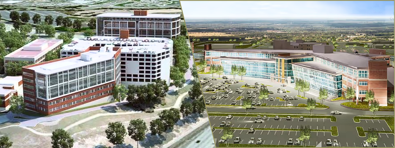
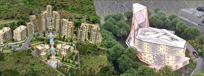
An aerial property rendering is a visual representation of a development that is viewed from above, or from an elevated perspective. Instead of the common architectural renderings that are taken from street level, the aerial image enables you to present the property and, at the same time, the surroundings. As with the project’s requirement, it does matter and depends on whether the image can just cover the immediate site needed or several blocks, the neighborhood, and the larger geographic area.
Significance and its application
With the use of the aerial view, it will be efficient to communicate especially in showing the property’s relationship to the highways, and major roads, the distances from the airports, train stations, and transit stops, the proximity to beaches, rivers, lakes, and other natural features, as well as with the nearby retail, schools, restaurants, hospitals, offices, the neighboring properties, landscaping and open spaces, the future developments, and the construction phases, and the overall site accessibility. For projects where location is a component of the selling proposition, this more comprehensive viewpoint is particularly helpful.
Why context matters in real estate visualization?
Context and value
A property does not exist alone; it is being influenced by what surrounds it. The value of the property can be impacted by various reasons. An example of this is that a development that is near a highway can have various advantages and disadvantages compared to one that is in a quiet residential district. A resort with a view of the ocean has a different selling point than a hotel close to an airport. There could be a lot of potential in the future for a mixed-use development surrounded by new infrastructure. The aerialdesign visualization services can highlight the connections.
For the investors, the aerial renderings can help in a way that it can communicate the potential developments, the accessibility, the market positioning, as well as the relationship between the proposed project and its surroundings. As well as, for the buyers, the location can be a big advantage for easy understanding. Rather than completely reading descriptions such as the property is close to nearby hotels, restaurants, and public transportation, it is difficult to visualize. But with the use of aerial visualization, it can be easier to see that the destination is in line with the developments.
On the other hand, the aerial and site plan images can help zoning officials and planning authorities understand how a proposed development interacts with nearby roads, properties, pedestrian routes, public areas, and infrastructure. Hence, a more comprehensive narrative is the outcome. “What will the property look like?” is addressed by a ground-level rendering. “Where does this property fit?” is addressed by an aerial rendering. By providing an answer to the question, “How will the entire development work?” a site plan rendering goes one step further.
Two ways to create an aerial rendering
In aerial property visualization, there are two major production approaches that are being utilized. One is through drone photography composites, and the other is Full CGI aerial renderings. These two approaches can produce convincing results, but they can show differences in various situations and contexts.
A drone composite does begin with the real aerial photograph of the property. A licensed drone pilot is responsible for capturing what an existing site is based on the appropriate altitudes and angles. In comparison, the freelance architectural visualization team can integrate the proposed buildings or even the development into the photograph.
The workflow typically looks like this:
Real site
Drone photography
3D building model
Camera matching
Lighting matching
Compositing
The biggest advantage of it is the realism. The photograph can depict what the surrounding environment will look like. Even the roads, trees, nearby structures, utility infrastructure, topography, parking lots, and other visual components can be taken from the actual site.
One of the most crucial steps in the overall procedure is the matching and aligning of the camera. The drone photo and the 3D model design services need to be positioned from the same angle. The building may appear to have been pasted onto the picture if the camera angle, focal length, height, or perspective are all off. Experts such as visualization artists can examine the source image and replicate its camera properties in a three-dimensional setting.
Lighting is a big contributing factor that must be matched. If the drone photograph presents the long shadows that extend towards the east, the building in the CGI should be producing shadows, making it consistent within that direction. The artists can replicate the approximate time of day, sun position, cloud cover, and general brightness, and other needed components. A composite may appear artificial due to even minor discrepancies
The final step must involve matching the atmospheric characteristics, and that includes the haze, the sky conditions, the contrast, color temperature, atmospheric perspectives, the reflections, exposure, as well as the appearance of the vegetation. When all of these elements are utilized properly and rightly, the proposed building cannot be recognized from the real existing environment.
When do drone composites work best?
Drone composites are effective, especially when they are used correctly, such as when the site is accessible for aerial photography, the presentation depends on the surrounding environment, the scenery is eye-catching, the developer desires the highest level of realism, the current surroundings are comparatively stable, and the buyers who need to know the precise location are being marketed the project. The reliance of the project on the actual site may face a primary drawback. If flying over the property is neither safe nor permitted, it may be difficult to obtain suitable photography.
The next approach would be to create and build a digital aerial environment. Rather than beginning with the drone photograph, the artists are able to make a 3D environment with the available information such as the survey data, the CAD drawing services, GIS information, the mapping data, satellite imagery, the terrain data, the footprints of the building, the road networks, as well as the information of the existing sites.
The main benefit of using a full-CGI rendering is that the rendering team has complete control over the image. Seasons, time of day, weather, vegetation, surrounding buildings, traffic, landscaping, and more can all be altered to best suit the needs of the client. Full-CGI renderings are incredibly beneficial for developments that will change over time. A drone photo may show an empty site, but a full-CGI rendering can show the potential for that site in the future.
Showing the development phases
There are a lot of developments that are completed in phases over the past years. This means that an investor or buyer may only be able to see the project as it is being built or see an empty site. With renderings, a visualization team can show what the development looked like before, during, and after the development period. Associating and utilizing these types of renderings enables the clients and buyers to understand the full scope of a project.
At first glance, all of the aerial and architectural site plan services may look similar, but they are not; they often serve very different purposes. An aerial rendering focuses on the property and its surroundings. Because an aerial rendering can be so realistic, it may even look like a photo that was taken by a drone. A site plan, on the other hand, is more about showing the organization of the development.
A site plan rendering may use a bird’s-eye view, but the graphics may be simplified for the viewer. The information shown in a site plan rendering may include property lines, individual building footprints, roads, driveways, sidewalks, parks, pools, clubhouses, landscaping, traffic patterns, utilities, and much more. Overall, the aerial rendering can make it possible for the viewers to see the property and its surroundings, while a site plan shows the viewer the organization of the development.
Why are site plan renderings important?
Many large-scale developments require an extensive amount of planning before any ground is broken. This usually entails that there will be a site plan involved. A site plan is usually complicated, and it may include a lot of notes, measurements, symbols, and other information. This information is incredibly important for engineers and planners, but it can be difficult for buyers, investors, and others to understand. A rendered site plan can help clarify the information by adding buildings, landscaping, roads, and other familiar elements. A rendered site plan can make a complicated series of drawings much more accessible to a buyer or investor.
Imagine a master-planned community that includes hundreds of residential lots, a clubhouse, pools, parks, trails, retail, a school, and several roadways. These types of developments can be incredibly difficult to understand when looking at a technical plan, but a rendered site plan can help clarify the layout of the development. Because of this, a rendered site plan can become a valuable marketing tool for a development. It can be used in sales centers, on websites, in presentations, to investors, and more.
Not all site plan renderings are done from a bird’s-eye view. There are still individuals who use a lower angle to show off the development while still keeping the familiarity of a site plan rendering. This allows a rendering team to create something that looks similar to an architectural rendering services while still keeping the wider perspective of a site plan rendering. Instead of looking at building footprints, the viewer can see building facades, trees, and more. This can be a great option for residential developments, resorts, mixed-use projects, commercial developments, and more.
Showing the development phases
Many large-scale developments are built in phases over the course of several years. Because of this, one rendering may not be enough to show what a buyer or investor can expect. A freelance visualization design team may create a few renderings that show different phases of the development.
The first image should show what has already been built, while the second image may show what has yet to be built. One option is to create a before-and-after rendering, in which it would explain that one image will show what the site looked like prior to the development and the second image will show what the development can be expected to look like in the future.
Zoning authorities may have their own concerns when looking at a rendering. They may be more concerned with the relationship between the development and the surrounding buildings, roadways, and natural landforms. A clear and concise aerial or site plan rendering services can help them see the project as clearly as possible for meetings and presentations.
Buyers and future residents are likely to be concerned with what they will be able to see and do when the project is completed. They may care about how far the nearest highway is or how close the nearest park is. An aerial rendering can show them all of these things at a glance. It can show them the value of a master-planned community and where their home or lot may be located in relation to other buildings.
Typical cost of aerial and site plan rendering services
Rendering Service
Typical Cost
Best For
Basic exterior rendering
$1,400–$2,800
Building exteriors and simple surroundings
Aerial property rendering
$1,500–$3,000+
Showing the property and surrounding area
Site plan rendering
$1,000–$2,500+
Residential and commercial developments
Detailed aerial CGI
$2,000–$4,000+
Large properties with detailed surroundings
Drone photo + CGI composite
$1,500–$3,500+
Existing sites requiring photorealistic context
Large development/master plan
$3,000+
Communities, resorts, parks, and mixed-use projects
360° exterior/panorama
$1,500–$2,500
Interactive property presentations
What to give the rendering team?
The more information that is given to a rendering team, the more accurate the rendering will be. The following information can be helpful to a rendering team: Site plan CAD files, survey information, drone photography (if available), architectural models, landscaping design services, development phasing information. Hence, the more accurate this information is, the more accurate the rendering will be.
A building can look nice in an architectural rendering, but it does not always tell the full story. An aerial rendering shows the property in a larger perspective. It shows the value of a development by placing it in context with the surrounding area, amenities, and more. It helps buyers and investors understand what this development can offer. In other words, while an architectural rendering can show the beauty of a building, an aerial rendering design services can show the opportunity of a development.
Drone vs. CGI
There are two options when it comes to the topic of aerial renderings: the drone composite and the full CGI rendering. A drone composite is a better option when the site is accessible to people, the surrounding area is desirable, it is really important to have photorealism, and high-quality aerial photography is available. A full-CGI rendering is a better option when the site is inaccessible or undeveloped, the surrounding area is undesirable or will change, there is a need to show different time periods, and more control is needed.
The two options can also be combined. A drone photo can provide a realistic image of the world while CGI can be used to add buildings, landscaping design services, and more. This allows a rendering team to show buyers and investors the current state of the world while also showing them the future potential of the development.
By utilizing or having a strong site plan, it can offer a benefit to both the buyers and the planners. For the sales teams, a strong site plan rendering is helpful, as it can make the development easier to understand, which can help it stand out from the competition. On the other hand, for the planners and officials, it can show them how the development would fit together and how it would relate to the world around it. As for everyone else, it enables us to show what the finished development would look like and how it will change the region. This versatility makes it a valuable tool for residential, commercial, hospitality, mixed-use, and industrial projects, as well as for large-scale master-planned developments.
Conclusion
A property is more than just a building. It is part of a much larger world that includes roads, other buildings, natural landforms, and more. An architectural rendering can show the beauty of a building, but it does not always show the value of a development. Aerial and site plan renderings show the bigger picture and allow buyers, planners, and more to understand the potential of a development.
Drone composites are a great option when the site is accessible, the world around the development is desirable, and photorealism is needed. Full-CGI renderings are a better option when the site is inaccessible or undeveloped, the world around the development is undesirable or will change, and more control is needed. Site plan renderings help buyers understand the development and help planners understand the development’s impact on the world around it. In the end, an aerial or site plan rendering is about telling the story of a development and showing its potential. Connect with vetted freelancers in Cad Crowd to help you with either aerial or site plan renderings with confidence.
Cad Crowd connects developers, architects, and businesses with vetted 3D rendering professionals who can create aerial views, site plan renderings, drone composites, and full-CGI visuals. These experts can help showcase a property’s surroundings, layout, and future potential, making projects easier for buyers, investors, and planners to understand. Contact Cad Crowd today for a free quote.
MacKenzie Brown is the founder and CEO of Cad Crowd. With over 18 years of experience in launching and scaling platforms specializing in CAD services, product design, manufacturing, hardware, and software development, MacKenzie is a recognized authority in the engineering industry. Under his leadership, Cad Crowd serves esteemed clients like NASA, JPL, the U.S. Navy, and Fortune 500 companies, empowering innovators with access to high-quality design and engineering talent.